The integrated project team, which includes the NCC, PSPC and its technical advisor, has refined the design of the preferred concept for the Alexandra Bridge replacement, which takes into consideration feedback from public consultations, Indigenous communities and advisory committees.
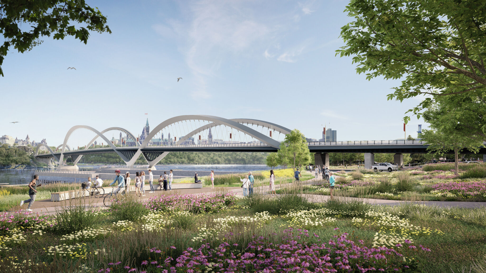
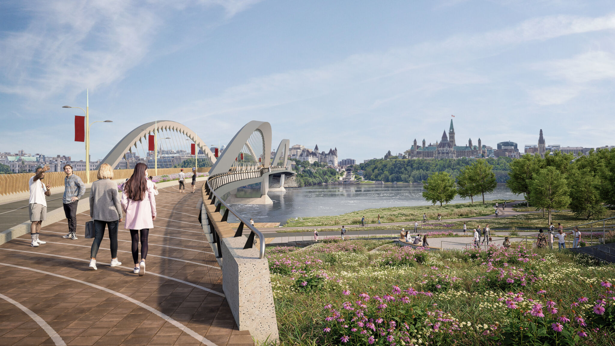
Inspired by nature and the movement of the river, the bridge’s form is defined by three undulating arches. These arches reference the river’s moving water, the contours of the shoreline and escarpment, and the curved facade of the Canadian Museum of History.
These renderings are for presentational/reference purposes. The design builder will further adapt the preferred concept.
Furnishings and seasonal comfort
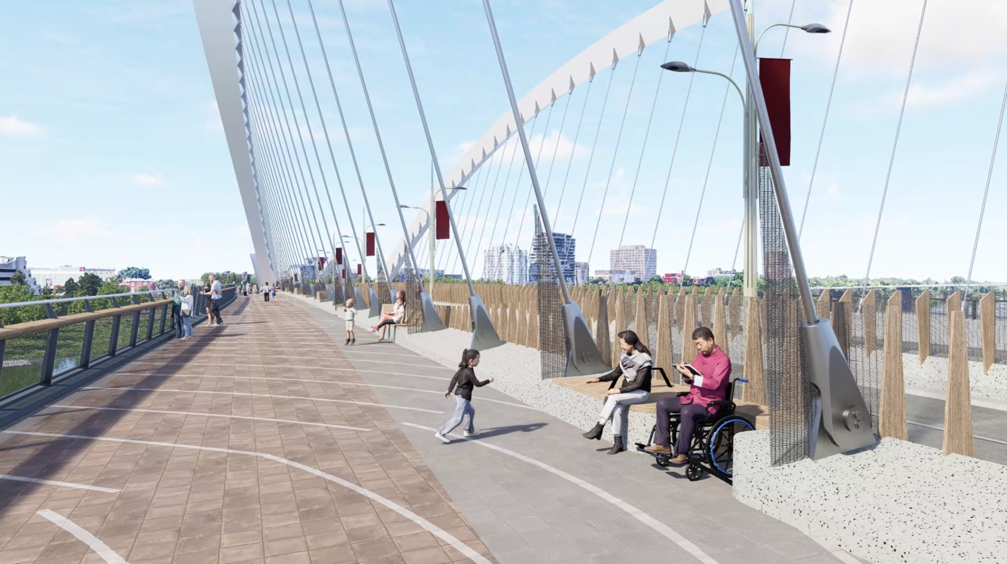
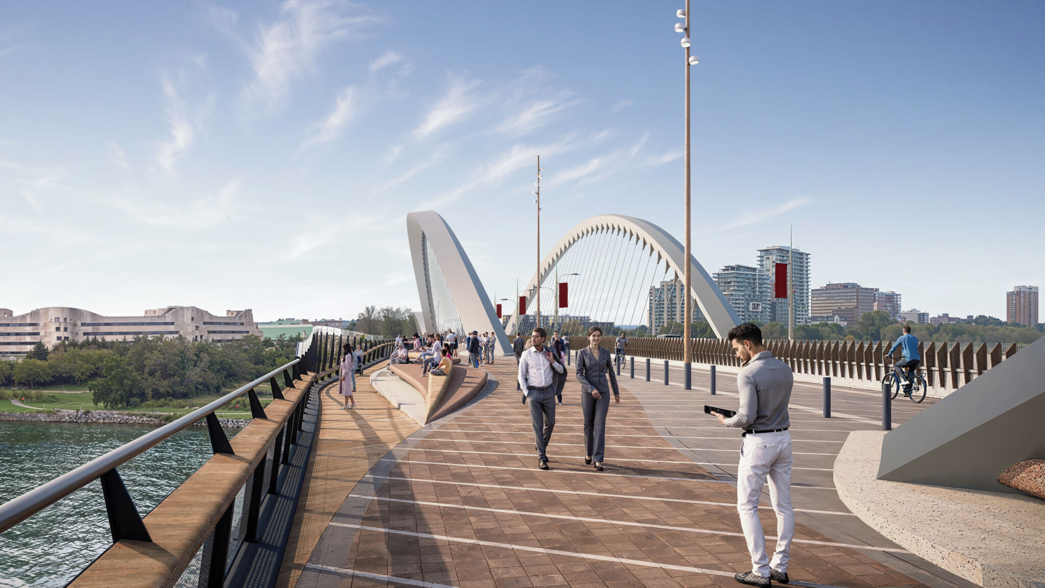
The bridge features several comfortable seating areas along its length that are designed for pedestrians and wheelchair users. There are also sheltered nooks located under the arches, and shading structures could be provided at seating locations along the bridge. Within the arches, two rows of timber panels provide protection from the wind, with additional wind protection provided at seating locations to improve comfort.
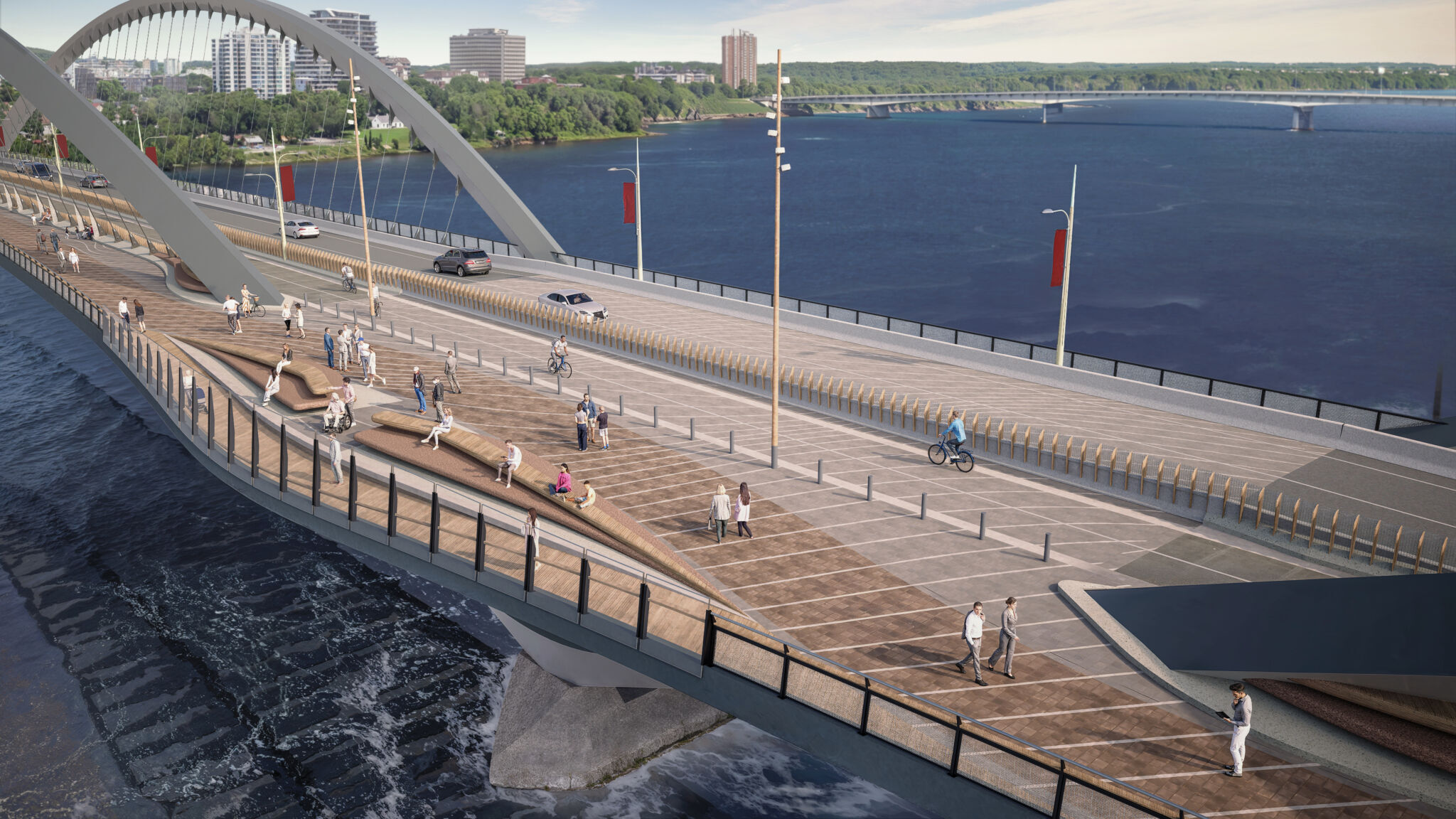
The lookout spaces could feature generous seating areas and central lookout points, offering uninterrupted views of the river and the central capital scene. Key seating locations along the bridge would similarly provide sheltered enjoyment of national symbols.
Safety and separation of modes of transportation
The bridge has been designed to ensure a seamless connection between the cities of Ottawa and Gatineau for pedestrians, cyclists and drivers.
The pedestrian space varies in width, from a minimum width of 4.6 metres (plus a 1.9-metre seating zone) to a maximum of 12.0 metres at the two lookout spaces located between the arches. The seating zone below the arches and the wind screen provide continuous separation between the cycleway and pedestrian deck. Bollards demarcate the cycleway at the lookout spaces.
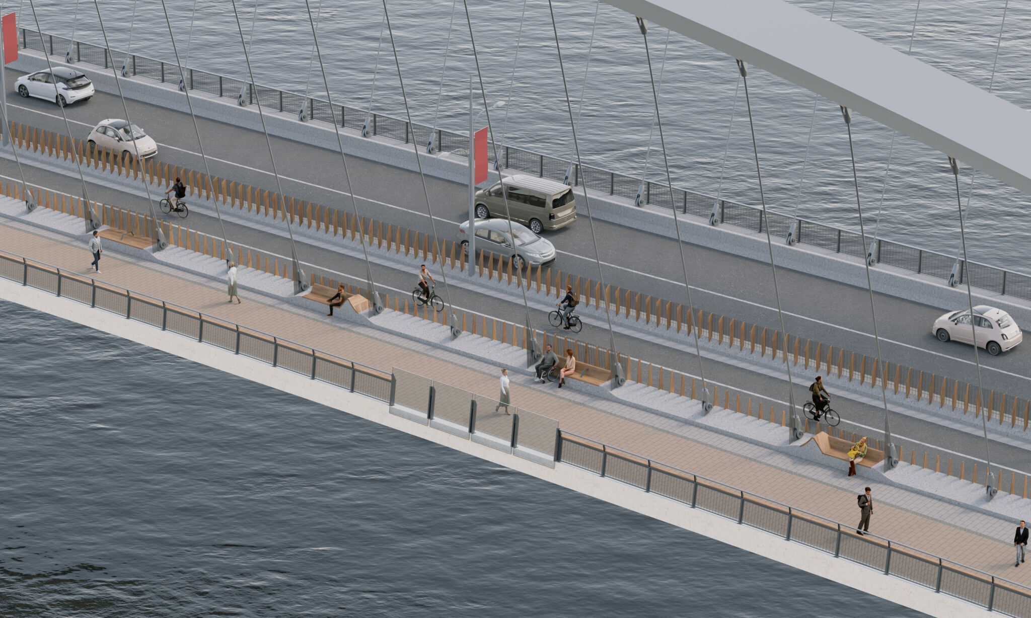
The cycleway provides a smooth, straight route across the river, and ample space for cyclists of all experience levels to ride comfortably. With a clear width of 4 metres and 0.5-metre buffer zones on either side, the cycleway is designed to accommodate high traffic volumes in favourable weather, and has space for snow storage in the winter, ensuring safe and reliable year-round access.
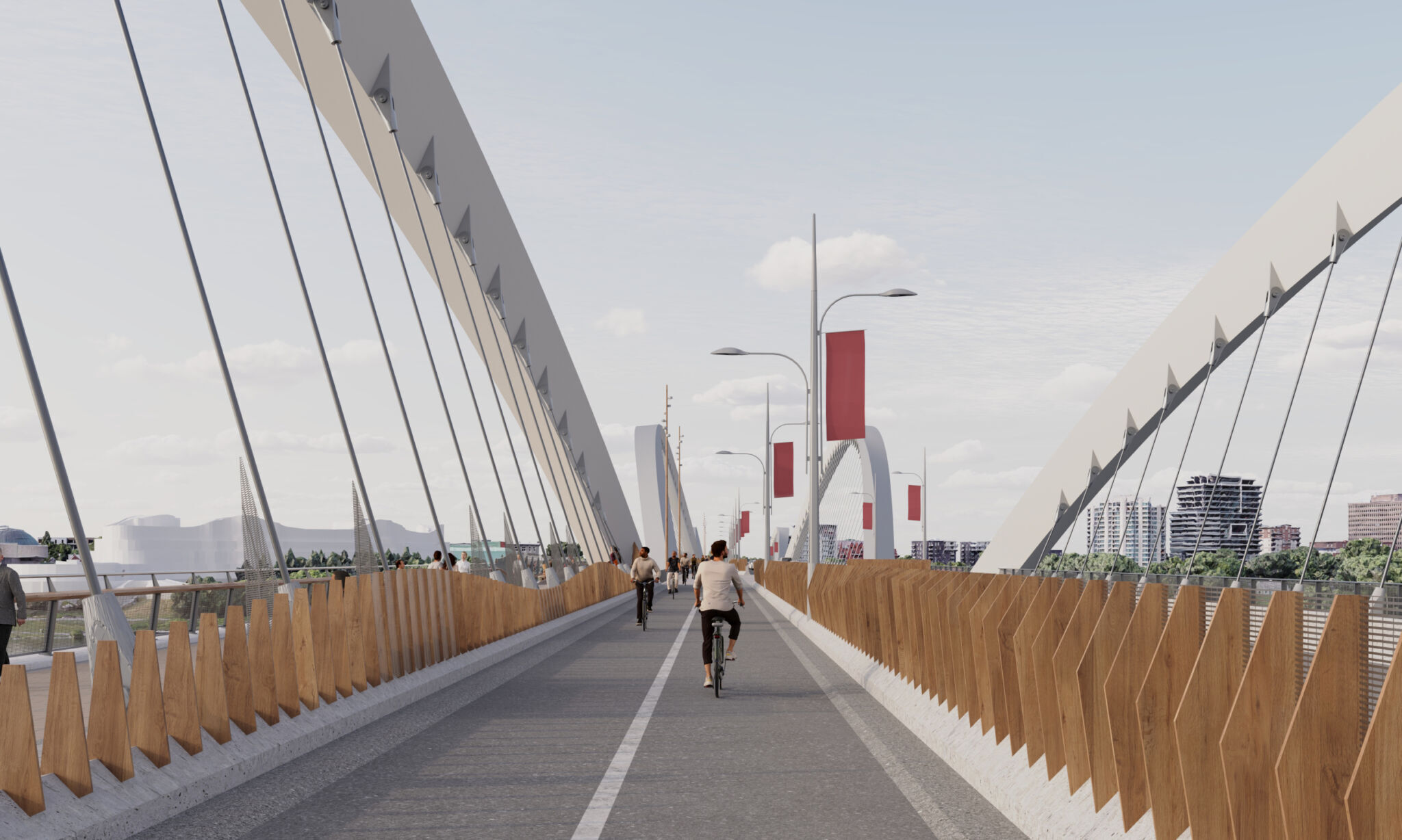
The cycling experience is further improved by raising the cycle path 350 millimetres above the roadway. A concrete safety barrier runs along the cycle path, keeping cyclists separated from vehicles. Vertical panels, mounted on the barrier, block strong winds and improve comfort for riders.
Universal access
The design of the upstream edge of the bridge provides a range of enjoyable experiences for pedestrians and cyclists, from the everyday commuter to the first-time visitor. The railing is designed to be strong and secure, helping those who might find crossing bridges intimidating, while transparency is provided to allow all users to enjoy views.
At four locations along the bridge—at the ends and at the public spaces—there are locations for cyclists to dismount and safely enter the pedestrian path. These exits are indicated with contrasting surface finishes and textures, including tactile markers at thresholds and around obstacles, such as seating and lamp posts. Every access point to the deck will be level to allow those requiring mobility aids to navigate them easily.
The design of the new bridge will present a significant acoustic improvement compared to that of the existing Alexandra Bridge. The new continuous asphalt roadway will be more beneficial than the open steel grillage roadway on the existing bridge, reducing overall noise emissions and creating a quieter, more comfortable environment for all users, including individuals with sensory sensitivities or hearing impairments.
Shoreline connectivity
The Ottawa River (Kichi Zībī) provides a rich and diverse natural setting for the Alexandra Bridge, which remains a key feature of the landscape in the National Capital Region. The river’s shoreline features a variety of settings, from wooded and rocky natural sites to landscaped parks with open lawns, pathways and cultural landmarks.
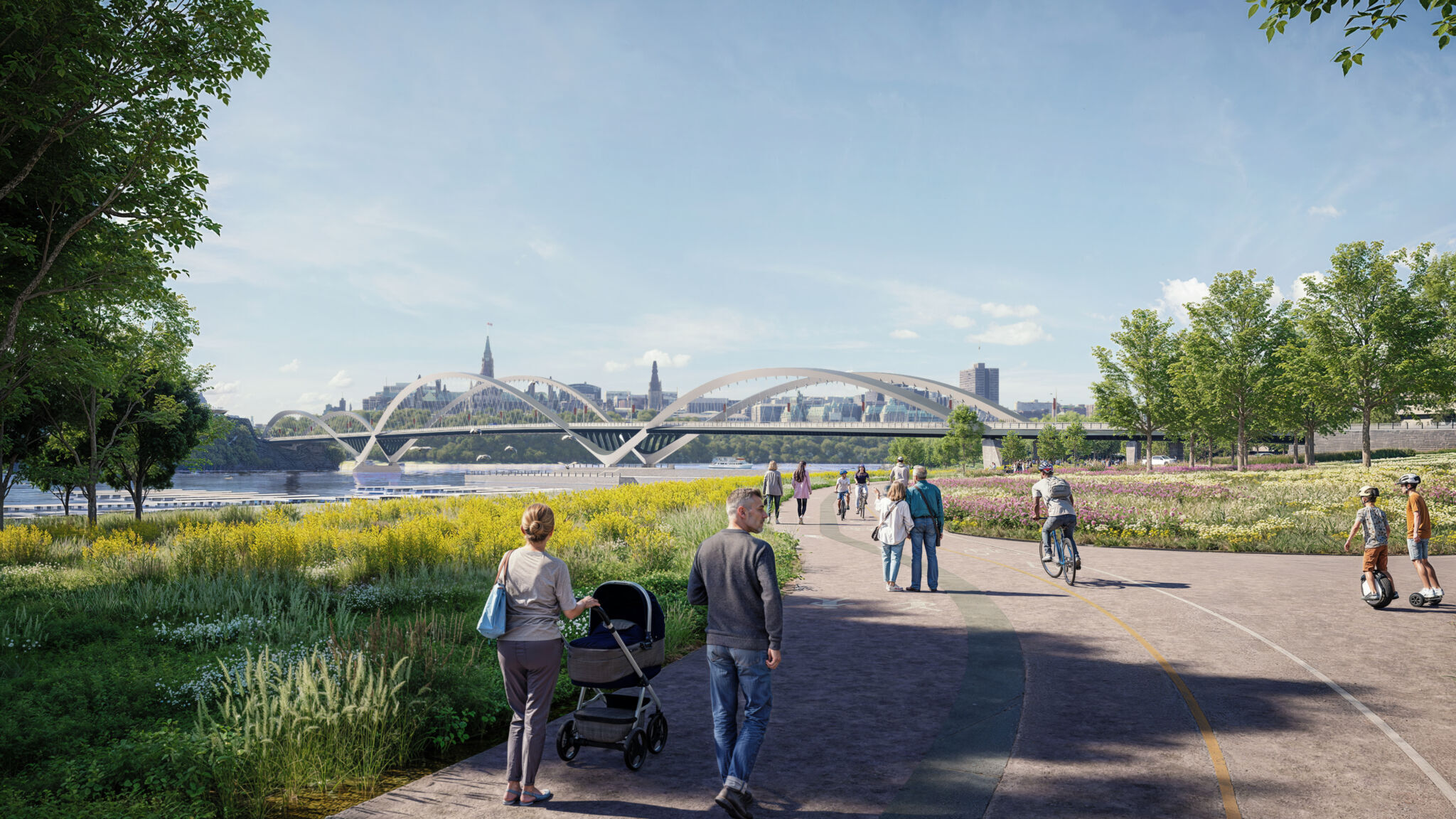
Representative of the area’s resilience and biodiversity amid an urban setting, the Ottawa River corridor is home to the natural habitats for many species while also providing continuous connections to the multi-use paths along its shoreline.
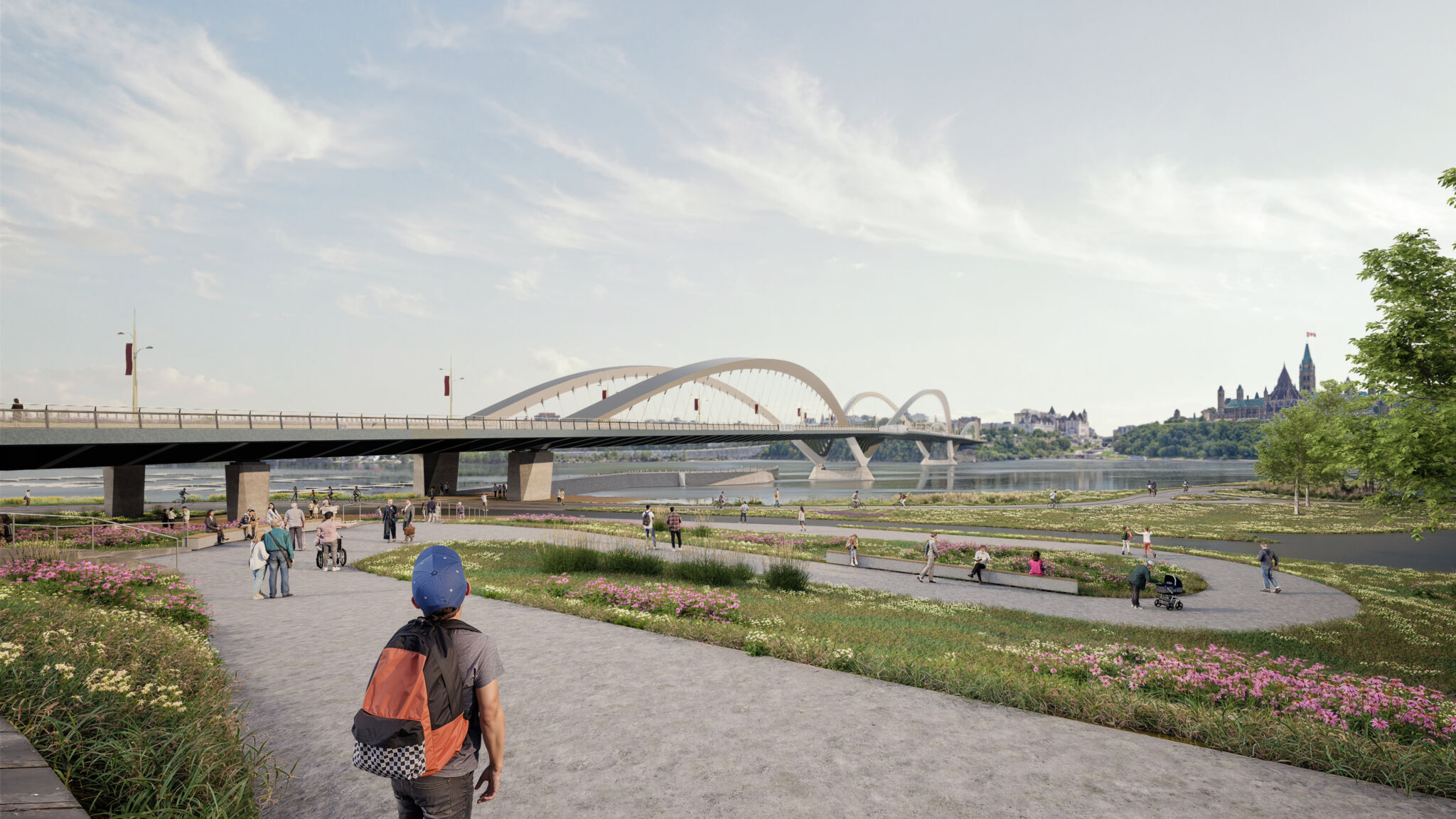
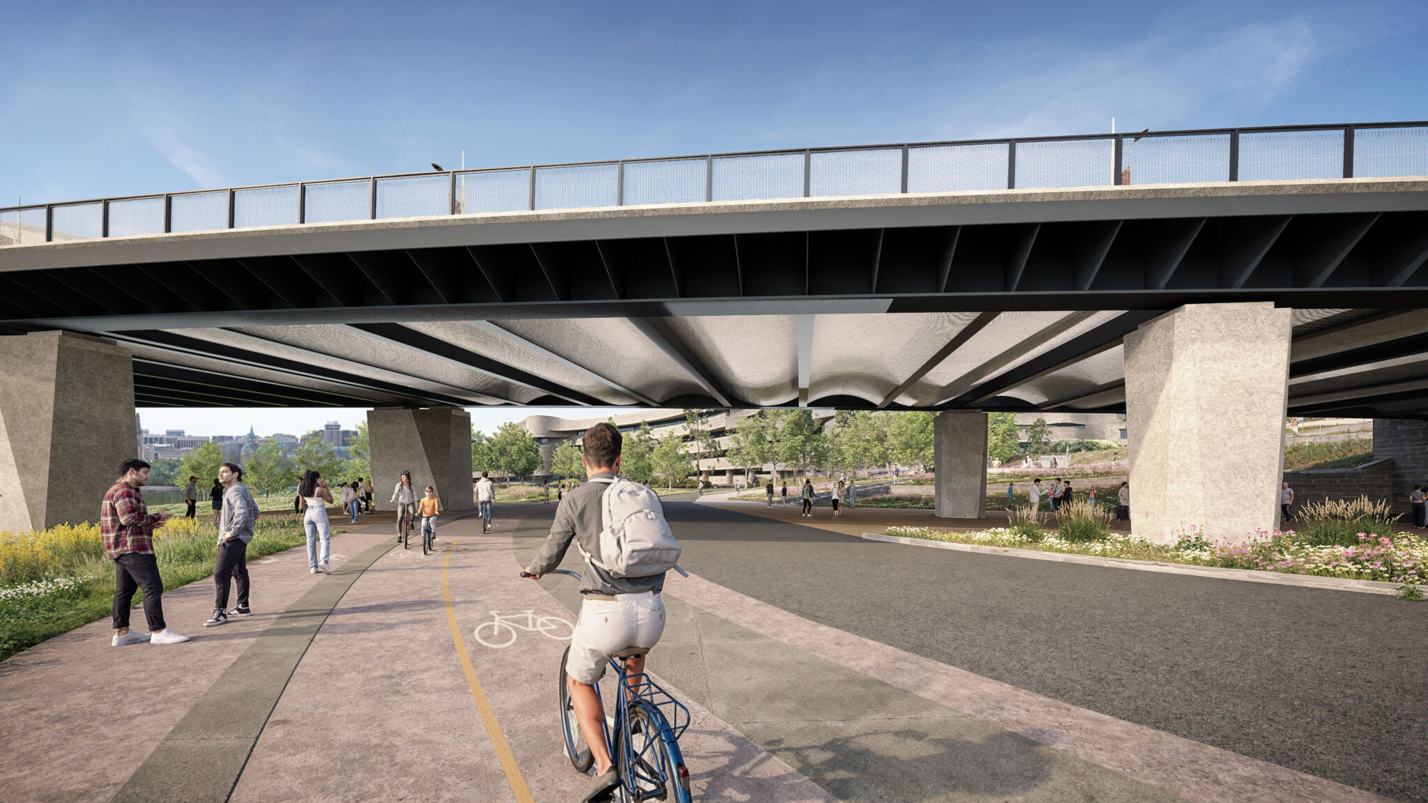
The bridge approaches are positioned sensitively on the river’s shorelines and escarpment, maintaining a cohesive, green, connected corridor, while also enhancing existing pathways and supporting the development of new connections.
The pathways along the shorelines connect users to Confederation Boulevard, the capital’s ceremonial and discovery route, and its surrounding landmarks, including the Canadian Museum of History and Jacques-Cartier Park along the north shore of the river, and Kìwekì Point and Major’s Hill Park on the south shore.
These connections, both improved existing pathways and new connections, shall be direct, visible and safe in all seasons, offering an inviting, accessible and comfortable user experience along the north shore, south shore and under the bridge for both pedestrians and cyclists.
Project newsletter
We will send updates to the project newsletter list. To join our mailing list, please email consultations@ncc-ccn.ca.